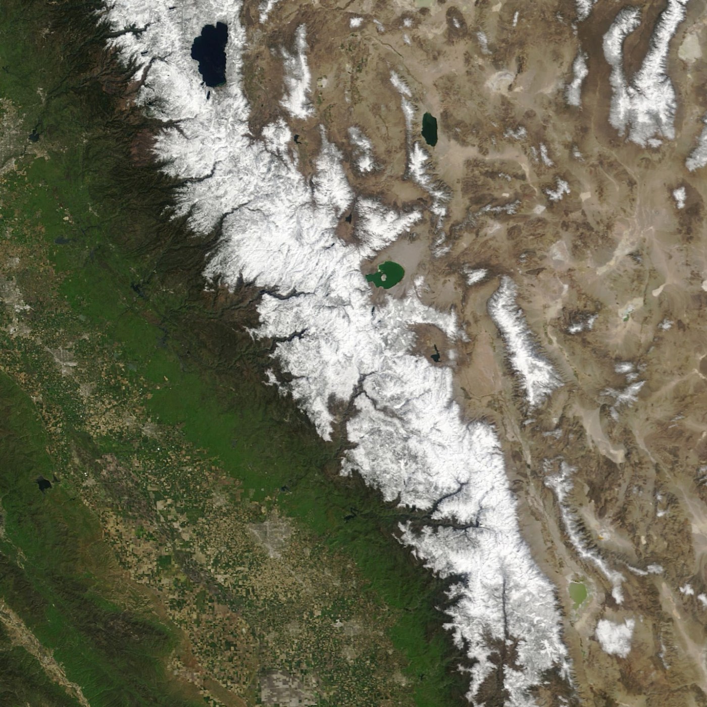
For the second year in a row, snow in the Sierra Nevada mountains has been higher than normal. This follows three years where the snowpack was low and contributed to drought conditions in the state.
NASA images of Sierra snowpack. From left to right: 2021, 2022, 2023, 2024. (NASA Earth Observatory images by Wanmei Liang, using MODIS data from NASA EOSDIS LANCE and GIBS/Worldview.)
Snowpack throughout the Sierra range was slightly higher than average, 110 percent, on April 1, 2024, according to the California Department of Water Resources (DWR). This is compared to 59 percent of average in 2021.
NASA’s took a current satellite image of the mountain range, which supplies about 30 percent of the state’s water needs, and laid it beside the previous three years. Last year, the snowpack was a whopping 247 percent of normal.
Unlike last year when a number of strong atmospheric rivers pounded the state, however, this year the snowpack benefitted from a more average rainy season.
Related Articles
How a different type of atmospheric river storm saved California from another drought
Gov. Newsom announces updated water plan amid above-average Sierra snowpack
Sierra Nevada snowpack ‘unusually normal’ and reservoirs are brimming as winter season winds down


