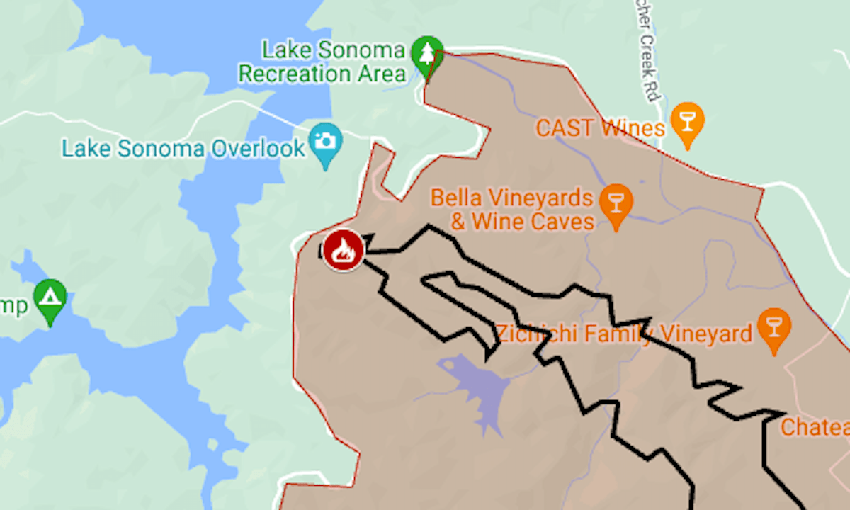
A wildfire that started on Sunday northwest of Healdsburg prompted an evacuation order and was threatening wineries.
Related Articles
Point Fire prompts evacuations in Sonoma County, burns 1,000 acres
Post Fire map: Evacuation near I-5’s Grapevine section
Crews contain 19-acre East San Jose foothills grass fire
Bay Area to see moderate fire danger concerns this weekend
Power demand expected to double by 2040 thanks to AI and EVs, PG&E’s CEO says
The Point Fire had burned 1,100 acres (1.6 square miles) as of Sunday night, said the California Department of Forestry and Fire Protection. On the map above, the approximate perimeter is indicated by the black line and the mandatory evacuation area by the red tint.
For official updates and details, including the warning zone, see the Sonoma County emergency website or the Facebook page or X feed of CalFire’s Sonoma-Lake-Napa unit.


