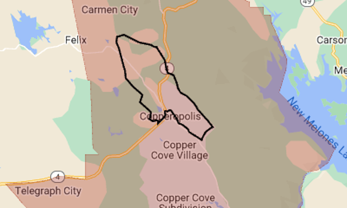
The Aero Fire, reported around 3:30 p.m. Monday in the Sierra Nevada foothills, grew within hours to more than 5,000 acres, up to the edge of Copperopolis.
Related Articles
Map: Wildfires burning across California as dry, windy weather continues
Wineries on high alert as Point Fire burns in Sonoma County
Point Fire map: Evacuations in Sonoma County wine country
Point Fire prompts evacuations in Sonoma County, burns 1,100 acres
Post Fire map: Evacuation expanded for biggest wildfire of California’s season
An evacuation was ordered for the community and the surrounding area. Highway 4 is closed through the fire area.
The map above shows the evacuation area in red. The black line indicates the approximate perimeter of the fire.
As of Tuesday morning, it had burned 5,239 acres (8.2 square miles), the California Department of Forestry and Fire Protection said.
Latest updates and more details can be found at the Calaveras County sheriff’s Facebook page and the Genasys Protect emergency zone map.