A wildfire that started July 3 has prompted the evacuation of almost 200 square miles in the mountains of Siskiyou County and the closure of a 50-mile stretch of the Pacific Crest Trail.
Related Articles
One final round for Bay Area heat wave before it says goodbye
Map: Lake Fire’s evacuation zone expands in Santa Barbara County
Los Gatos park fire started by a firework, county fire department says
Opinion: Wildfire smoke kills thousands of Californians a year. It doesn’t have to be so deadly
Fire breaks out near Santa Teresa County Park in south San Jose
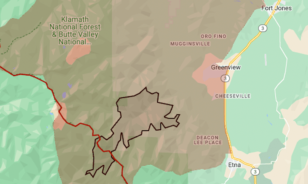
As of Wednesday, July 10, the Shelly Fire had burned 8,285 acres (13 square miles) and was 0% contained, the California Department of Forestry and Fire Protection said.
The mandatory evacuation area includes the community of Greenview in the Scott Valley, 15 miles west of Interstate 5. Fort Jones and Etna are under evacuation warnings.
The Pacific Crest Trail crosses through the active fire zone, and the Pacific Crest Trail Association is requesting that hikers stay off the stretch between Etna Summit and Seiad Valley.
The map above shows the approximate fire perimeter as a black line and the evacuation zone in red. For updates and details including warning zone boundaries, see the emergency map of Genasys Protect (formerly Zonehaven).
In Southern California, the Vista Fire has closed the Pacific Crest Trail in the area of Mount Baldy. The 2,650-mile trail runs between Canada and Mexico.