The explosive growth of the Park Fire continued overnight, and firefighters expect another day of gusty winds and low humidity.
Related Articles
As California wildfires rage, one Bay Area insurer uses AI for coverage
Northern California Park Fire triples in size in a day
Map: Macy fire burning in Southern California
Crews battle 500-acre brush fire northeast of Livermore
DA identifies man accused of starting Park Fire
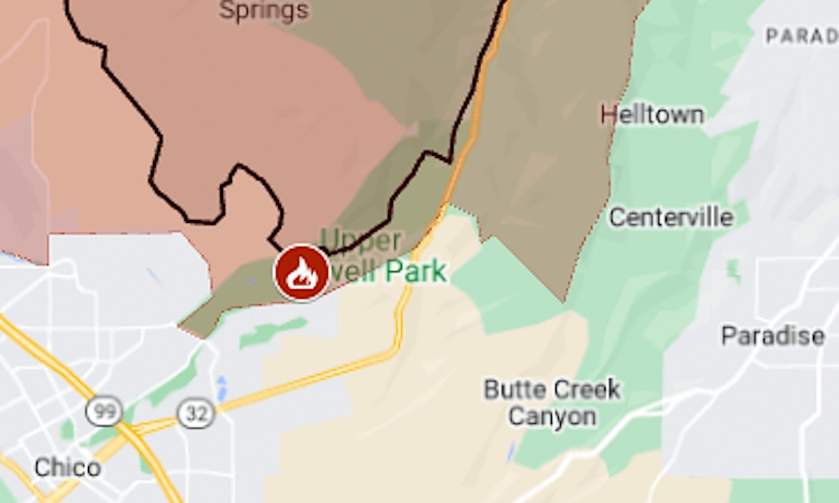
The Park Fire started Wednesday afternoon in Chico’s Upper Bidwell Park, and within 12 hours it was the state’s biggest wildfire of the season, the California Department of Forestry and Fire Protection said.
By early Friday it was 164,286 acres (256 square miles), CalFire said. That’s more than four times the size of this year’s second-biggest fire, Lake, which burned 38,664 acres in Santa Barbara County.
The map above shows the Park Fire’s approximate perimeter as a black line and the evacuation area in red.
CalFire investigators say the fire started when a man pushed a burning car down an embankment into a brush-filled gully. A suspect has been arrested.
Evacuation orders covered more than 630 square miles in Butte and Tehama counties, with more zones coming under the order on Friday.
At a news conference Thursday, Butte County Sheriff Kory Honea expressed frustration that many residents were not complying with the instruction to leave. He referred to the death toll of the 2018 Camp Fire, and said, “I don’t know how to keep saying this over and over again. People have got to know their zones. … In addition to that, you have to be prepared to go.”
Honea said that, in the evacuation zone in the community of Cohasset on Wednesday night, he encountered “numerous people who were not prepared to go,” including three whose cars were out of gas. On Thursday, the fire swept through Cohasset.
Coming under evacuation orders late Thursday afternoon were Butte County’s Doe Mill Ridge and more than 100 square miles in Tehama County north of the fire perimeter. Helltown, Centerville and part of Paradise came under warnings.
A red-flag warning, indicating heightened fire risk because of weather conditions, is in effect for the area until 11 p.m. Friday.
For details of the evacuation zone, including warning areas, see the Butte County evacuation map or the Genasys Protect map (Tehama County only).