A wildfire that started late Tuesday has prompted evacuations of Sierra Nevada communities near Placerville.
Related Articles
Opinion: We need a new Smokey Bear that embraces good fire
Air quality advisory issued as wildfire smoke blankets Bay Area
Grass fire spreads to barn, abandoned buildings off Montague Expressway
Wildfires create smoke clouds that hold heat and warm the earth, researchers say
Crews unable to increase containment on Park Fire
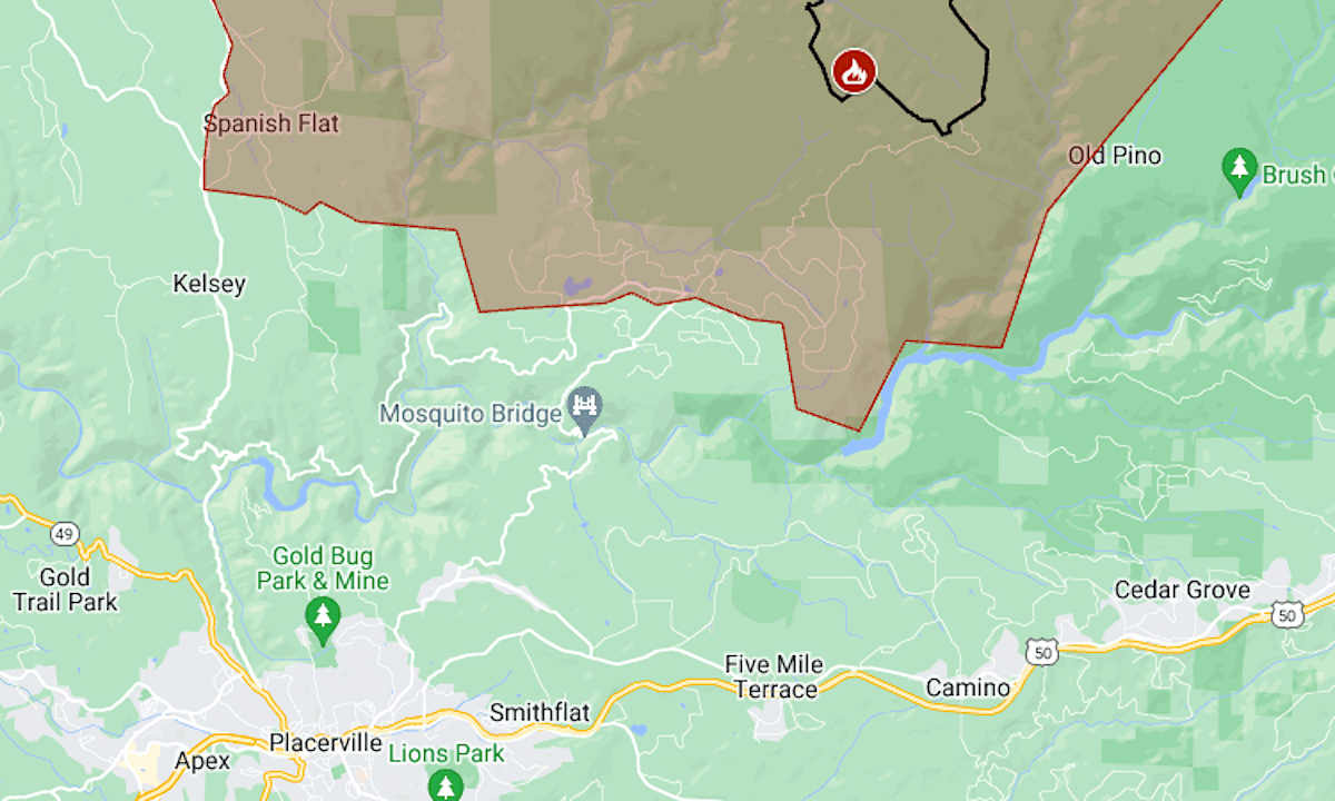
The Crozier Fire was reported around 11 p.m. Aug. 6 as a half-acre vegetation fire about 6 miles north of the Highway 50 town of Camino.
The first evacuations were ordered in the early hours of Wednesday. By that evening, the zone had grown to include the communities of Volcanoville, Quintette and Spanish Flat and part of Georgetown.
The map above shows the approximate perimeter as a black line and the evacuation area in red.
Friday morning’s report by the California Department of Forestry and Fire Protection put Crozier’s size at 1,705 acres (2.8 square miles) with 5% containment.
Smoke from the fire was causing air pollution over Lake Tahoe, 40 miles to the northeast. On Thursday, the air quality index in Tahoma, on the west shore, was 181, in the “unhealthy for everyone” range.
Crozier is about 8 miles from the footprint of the Caldor Fire, which burned 221,835 acres in 2021.
For more details of the evacuation, including warnings, see the map on Perimeter. El Dorado County has set up a non-emergency line for fire information at (530) 621-7676.