A wildfire burning above the Klamath River has prompted evacuation orders in Humboldt and Siskiyou counties.
Related Articles
Marin County grass fire burns 18 acres, prompts arrest
Nearly three weeks after starting, Park Fire nearing 430,000 acres
Map: Crozier Fire evacuation zone reduced in Sierra Nevada
Air Quality advisory effective through Sunday
Canyon Fire evacuation order lifted for Tuolumne, remains for its outskirts
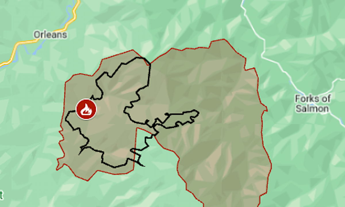
The Boise Fire started on Friday, Aug. 9, in Six Rivers National Forest above the community of Orleans, the California Department of Forestry and Fire Protection said. The first evacuation orders were called in Humboldt County that evening.
On Tuesday, Aug. 13, the fire grew from 3,600 acres to at least 7,223 acres (11.3 square miles), said fire managers for the U.S. Forest Service. There was 0% containment.
The actual size is likely larger, as smoke obscured the eastern edge during Tuesday night’s mapping flight.
Around sunrise Wednesday an evacuation was ordered in Siskiyou County in the mountains west of Forks of Salmon.
The map above shows the approximate fire perimeter as a black line and the evacuation area in red.
As of Wednesday morning, no structures had been reported damaged or destroyed, the Forest Service team said.
Details of the evacuations, including warning zones, can be found on the Genasys Protect map. An information site has been set up here, and a non-emergency phone line at (707) 572-4860.
The fire, named for Boise Creek, is just south of an area burned in last year’s SRF Lightning Complex.