The first evacuation order has been called for a wildfire that has been burning steadily for three weeks in Sequoia National Park and the adjacent national forest.
Related Articles
PETA billboard a ‘memorial’ to 70,000 chickens lost in California fire
Bay Area Allstate customers to face spiking home insurance premiums
Allstate approved to raise California home insurance rates by 34%
Man accused of starting Northern California wildfire by throwing firework out car window
California adds huge new wildfire-fighting aircraft two decades after famous crash
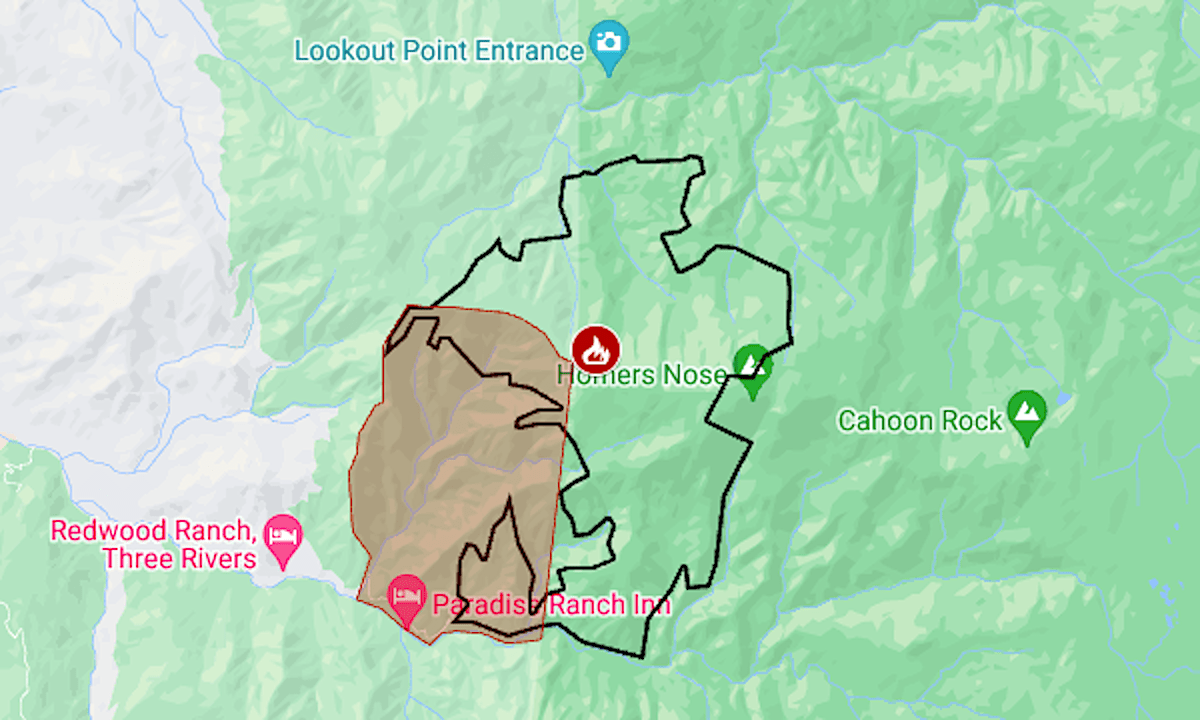
The Coffee Pot Fire was reported on Aug. 10 near Coffeepot Canyon, at the park’s west edge. As of Friday, Aug. 30, it had burned 6,994 acres (10.9 square miles) and was 3% contained, according to fire managers for the federal lands.
The mandatory evacuation called by the Tulare County sheriff covers 5½ sparsely populated square miles in Sequoia National Forest north of the South Fork Kaweah River.
The map above shows the approximate fire perimeter as a black line and the evacuation area in red. For more information on the evacuation, including warning areas, see the Genasys Protect map.
The fire has not experienced days of explosive growth but has grown steadily in all directions since it started.
Because of the fire, the park has closed some roads, trails and campgrounds, including in the Mineral King area. Visitors are warned of heavy smoke over the Labor Day weekend.