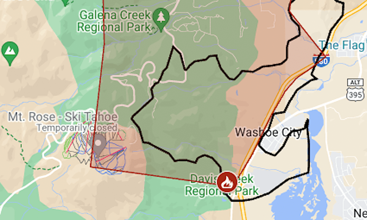
The warning area for the Davis Fire near Reno was expanded in the hours before a “dangerous” weather event was expected.
Related Articles
Wildfires rage out of control across Southern California
Map: Where Southern California’s three big wildfires are burning
Jeremy Renner thanks firefighters protecting Lake Tahoe home from Davis Fire
Map: Davis Fire between Reno and Mt. Rose entering ‘particularly dangerous’ phase
Evacuations still in effect at Boyles Fire near Clearlake
The National Weather Service issued a red-flag warning indicating a “particularly dangerous situation” — a status the agency called “exceptionally rare.” Such a warning was last issued in the Reno area in 2019, the agency said.
This time it is for hot and windy weather, with gusts up to 40 mph, expected along the Sierra front from 11 a.m. to 8 p.m. Wednesday.
“We fully expect that the Davis Fire is going to move and move significantly. Potentially up to 7 miles,” said a public announcement from the fire chiefs for Reno and the Truckee Meadows Fire District.
Evacuation warnings were announced for two new zones, extending to Reno’s South McCarran Boulevard. Residents were advised to have bags packed and to be ready to go if evacuation is made mandatory. “Take this seriously,” Washoe County’s social media accounts emphasized.
The fire, which started on Saturday, Sept. 7, had burned 5,828 acres (9.1 square miles) as of Tuesday evening, said fire managers for the Humboldt-Toiyabe National Forest.
It was 31% contained, on the fire line along Washoe Lake.
The map above shows the approximate perimeter as a black line and the mandatory evacuation area in red. For updates, see the Perimeter evacuation map or the Washoe County sheriff‘s Facebook page.
More wildfire news:
Map: Three major wildfires in the Los Angeles area have forced evacuations of 500 square miles
