Deemed the largest of the current wildfires in the state, the Bridge fire had burned 51,792 acres as of Thursday evening, Sept. 12, and was still at zero percent containment.
No deaths or significant injuries have been reported since the fire started Sunday afternoon, Sept. 8, in the East Fork area of the Angeles National Forest. Authorities are still investigating what caused the fire, which is burning in Los Angeles and San Bernardino counties.
Overnight the fire lessened in intensity due to better weather, decreased winds and higher humidity, said Nathan Judy, a spokesman for the California Interagency Incident Management Team 5.
Firefighters continued with structure protection in Wrightwood, Piñon Hills and Mt. Baldy.
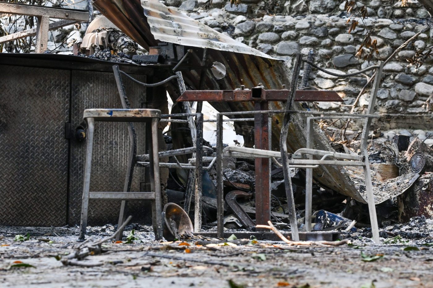
Los Angeles County Fire Chief Anthony Marrone said Wednesday that the fire had destroyed approximately 20 homes in Mt. Baldy, 13 homes in Wrightwood and six cabins in the wilderness area.
Here’s what we know:
Acres burned: 51,792 acres
Containment: 0
Structures burned: approximately 20 homes in Mt. Baldy, 13 homes in Wrightwood, 6 cabin in wilderness area
Fire personnel: 471
Cause of fire: Under investigation
When it started: Sept. 8
The firefight
Related Articles
Acalanes to play Del Oro after Davis Fire cancels game against Galena
An explosive California wildfire looked like a bomb went off from space – here’s what’s happening
Map: Airport, Bridge and Line fires burning in Southern California
This is what Southern California wildfires destroyed in 7 days
Airport fire destroys cabins in historic Holy Jim Canyon
The north side of the fire was the most active on Wednesday, but more favorable weather conditions helped firefighters doing structure defense in Piñon Hills, authorities said.
On the east side of the fire, firefighters held the fire west of Mt. Baldy Road, according to Judy.
The northwest section of the Bridge fire is in the wilderness area, which has steep, rugged terrain, Judy said. Firefighters are using aircraft to monitor that area.
The fire is not moving in the southwest portion of the Bridge Fire, he said. The fire was holding at Glendora Mountain Road and Glendora Ridge Road.
While Scott Brown has been in a hospital in Victorville, he’s been watching the fire move closer to his home in Pinon Hills. When the area was under evacuation warning on Wednesday, Sept. 11, a friend who lives on the same property packed up and later evacuated with Brown’s cats, computers and cameras.
The fire line was within a mile of Brown’s home in the southern part of Pinon Hills, he said, but he’s hopeful that firefighters can keep the blaze away.
Brown, who grew up in Southern California and worked as a firefighter in South Carolina for 10 years, said he’s never seen a wildfire grow as quickly and wide as the Bridge fire.
“This thing moved like nothing has ever moved before,” Brown said.
Evacuations and shelters
Still under evacuation orders were Wrightwood; Pinon Hills from Wrightwood north to Highway 18 and Beekley Road west to Los Angeles County; Lone Pine Canyon from Wrightwood to Highway 138/Lone Pine Canyon Road south to the forest; Highway 138 south to Lone Pine Canyon; and Highway 2 east to Lone Pine Canyon Road; Baldy Village from San Antonio Heights to Wrightwood and expanding east to Cucamonga Peak; and Camp Williams and a treatment center near it.
An evacuation warning was still in place in San Antonio Heights and Upland from the foothills south to 23rd Street, Phelan from Highway 138 east to Baldy Mesa Road and Phelan Road south to Sayle Road.
San Gabriel Canyon and East Fork of the San Gabriel Rive are still closed to forest visitors.
Highway 138 from Lone Pine Canyon Road to Beekley Road, Angeles Crest Highway (Highway 2) from Big Pines to Highway 138, Highway 39, East Fork Road, Glendora Ridge Road, Glendora Mountain Road and Mt. Baldy Road at Shinn Road intersection remain closed.
The evacuations centers include the San Bernardino County Fairgrounds at 14800 7th Street in Victorville; the Jessie Turner Health and Fitness Community Center at 15556 Summit Ave. in Fontana; and the Pomona Fairplex at 601 W. McKinley Ave. in Pomona (enter Gate 3 at the corner of McKinley and White avenues).
Pets and livestock can be taken to the Devore Animal Shelter, at 19777 Shelter Way in San Bernardino, and small animals to Palmdale Animal Care Center at 38550 Sierra Highway in Palmdale, and Lancaster Animal Care Center at 5210 W. Avenue I in Lancaster.
Residents with large animals also can go to the Antelope Valley Fairgrounds, at 2551 W. Avenue H in Lancaster. Call 562-706-8581 prior to arrival.