On a day when Southern California was braced for “critical fire weather,” a brush fire in the Pacific Palisades area quickly grew to 200 acres and prompted an evacuation order.
Related Articles
California’s green energy push has helped shove electric bills skyward: new state report
Cal Fire moves resources to Southern California as agencies brace for 80-100 mile per hour winds
Artificial intelligence spots a wildfire in a remote California canyon – and promptly alerts firefighters
Monthly bill relief comes into view for PG&E customers
Homeowners insurance company to pull out of California condo, rental markets
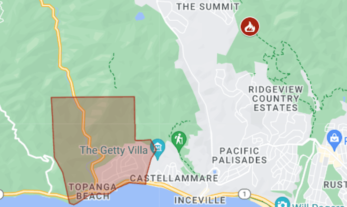
The Palisades Fire was reported around 10:30 a.m. Tuesday, Jan. 7, near the Temescal Ridge Trail. Within an hour, it was at 200 acres. The first evacuation order was in the Parker Mesa neighborhood, just west of the Getty Villa museum, and by 1 p.m. the zone had grown to more than 20 square miles.
The map above shows the evacuation area in red. For updates and details, including the warning areas, see the Genasys Protect map or the Los Angeles County emergency site.
The fire is about 8 miles from the burn zone of last month’s Franklin Fire, in Malibu.
The National Weather Service had warned of “extreme” winds, possibly reaching 100 mph, in the Los Angeles area, and officials responded by closing some roads and school campuses.


