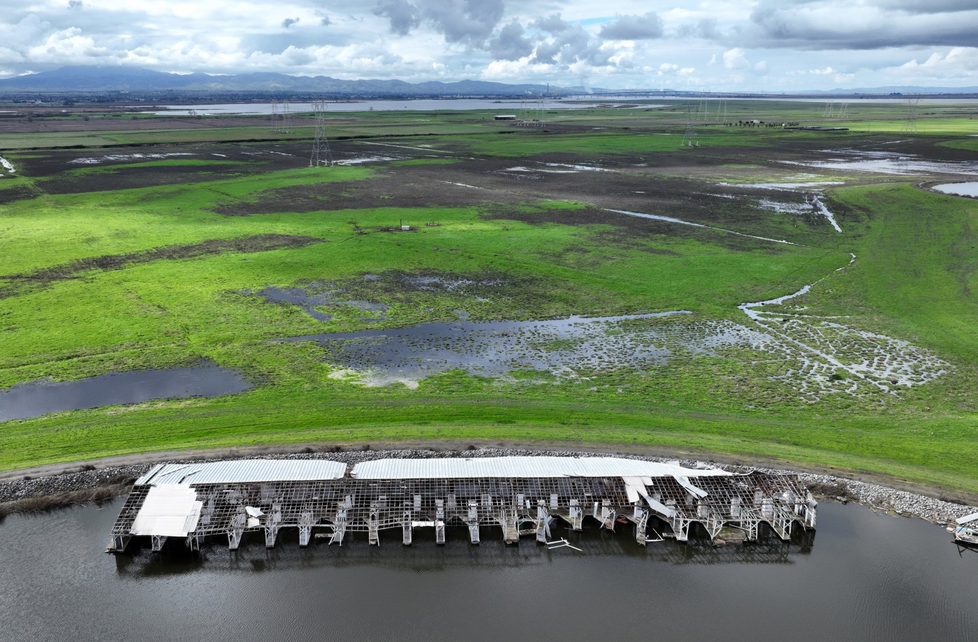
For more than three decades, Contra Costa County has drawn a line in the sand protecting the region’s verdant open space and sweeping ridgelines from urban sprawl.
Elected officials now have a rare opportunity to tweak that boundary — known as the urban limit line — which is one of local government’s most powerful tools for influencing community growth.
As the county stares down ambitious, state-mandated housing goals, there’s a chance the historically 20-year plan could be extended through at least 2050. But voters will have the final say on their June 2026 primary election ballots, after the Board of Supervisors accepted an initial report on Tuesday about a ballot measure to renew the urban limit line.
In November of 1990, a majority of voters agreed to only allow residential, commercial, industrial and other urban development on 35% of the land within the county – preserving the other two-thirds for agriculture, parks and other open space uses for at least two decades. Residents also embraced a 2006 ballot measure that renewed that urban limit line for another 20 years.
Will Nelson, one of the county’s principal planners responsible for forecasting development opportunities, said its impact is clear to the naked eye.
“So much of our natural environment and the things that make Contra Costa County special have remained undeveloped,” Nelson said during the Board of Supervisors meeting Tuesday, explaining how “We want to make sure that continues into the future.”
Related Articles
Housing development site in downtown San Jose staggers into default
Bishop Ranch in San Ramon seeks transformation into new neighborhood
Details emerge for San Jose housing project of 500-plus apartments
Raising Cane’s buys choice property near Berkeley campus
Heart health company expands with South Bay office deal
Beyond preservation, the urban limit line is intended to encourage infill development near downtown corridors and more densely populated neighborhoods.
Nelson said there’s still enough capacity within the current bounds of the urban limit line to accommodate upwards of 23,000 new housing units, 1.2 million square-feet of commercial space, and 5 million square-feet of new industrial development. These lofty benchmarks were adopted by the Board of Supervisors in November as part of the county’s 2045 General Plan.
Officials are now racing to finalize the next iteration of the urban limit line before the 20-year policy expires Dec. 31 — ensuring that the county’s general plan and ordinance code remain in line with past and future ballot measure amendments.
But rather than encroaching on existing open space or reducing allowable land use, Nelson said the county will fine tune those boundary lines to better “reflect reality” about existing land use and building potential.
Comparing a handful of the 50 maps that county staff drafted ahead of Tuesday’s presentation, he said it’s important to identify steep hillsides, high fire hazard zones, severe flood areas and other physical constraints within the urban limit line so that state and regional planners do not unintentionally over-inflate development mandates based on that map.
“Take Bethel Island — it’s inside the urban limit line, but there are many, many acres there that are several feet under sea level,” Nelson said, explaining how the county’s general plan does not allow development there, despite its inclusion within the voter-approved urban boundary. “We want to show where land is realistically going to be developed, keeping inappropriate land outside the line.”
Within staff’s recommended draft proposal, roughly 10,700 acres would be moved outside the boundary, while another 1,600 acres would be added.
The proposed modifications include simplifying the line along the shoreline, removing deed-restricted properties and updating any parcel lines that may have changed ownership in recent years .
Additionally, the renewed boundary would be aligned with established city limits in order to prevent developers from playing local governments against each other or pursuing land deals that take advantage of conflicting policies.
Contra Costa County’s urban limit line has drawn ire from local developers and environmentalists in recent years. A 125-unit, 30-acre project in the Tassajara Valley was hit by several lawsuits in 2021 after supervisors agreed to stretch the boundary east of Blackhawk in exchange for the preservation of 727 acres of open space.
Last summer, control of a 606-acre unincorporated agricultural preserve was ceded to the city of Pittsburg, which approved its own growth boundary in 2005 — ending years of delays and legal disputes over a controversial development concentrated around the Los Medanos Ridgeline.
“Some would argue that development should be more free market … but that model has not been helpful to California,” Nelson said, explaining that, in his view, the government’s role is to help guide housing development near jobs, schools and other existing services. “The purpose is not to protect (land outside the urban limit line) from imminent development, because I don’t think these areas are very developable. The purpose is really belt and suspenders — to better reflect reality and to have the line reflect where our real growth potential is.”
No matter what configuration is ultimately chosen for the renewed urban limit line, supervisors are currently only permitted to expand that boundary by 30 or fewer acres — a decision that requires a four-fifths vote to move forward. However, the board can also vote to exceed that cap, which would also require a countywide vote, or draft a ballot measure that allows some flexibility down the line.
County staff will start gathering feedback from residents and leaders in neighboring cities and municipalities through May before returning to the board this summer to start preparing a ballot measure. Environmental reviews and other planning documents are slated to be completed by next February in order to ask voters to renew the urban limit line on their June 2026 primary election ballots.
If those development boundaries aren’t renewed — regardless of their final form or configuration — Nelson said that failure to comply with regional growth management plans could jeopardize roughly $2 million in annual transportation sales tax revenues that are earmarked for local road, maintenance and transit projects.
As final details continue to ironed out, the board largely agreed one one thing this week: any renewal of the urban limit needs a fixed sunset date, rather than proposing a permanent policy.
“I think we should be cautious, because what I don’t want to do is have the public fearful that we have locked ourselves into some decision that their great grandchildren are going to have to suffer with,” said Supervisor Ken Carlson. “I really do want to make sure that we look at the urban limit line every time we’re doing our housing development update. It doesn’t have to be an in depth review, but as long as we’re staying on track, that’s really important to me.”