A week after it started in a rugged area of Santa Barbara County, the Lake Fire continues to expand and to prompt more evacuations. It is California’s biggest wildfire of the year.
Related Articles
Body found after woman reported missing near Mendocino County wildfire
Map: Shelly Fire exceeds 10,000 acres in Siskiyou County
How bad are wildfires going to be in California this summer?
Elias: California wildfire smoke’s fatal effects raise liability questions
When heat and fire danger are here, avoid these activities
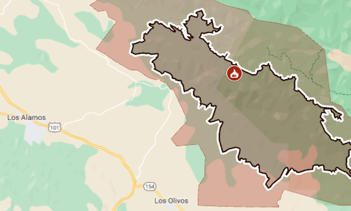
As of Friday, July 12, the fire had burned 38,004 acres (59.4 square miles) and was 19% contained, the California Department of Forestry and Fire Protection said.
The evacuation zone had grown for five straight days and now exceeds 150 square miles.
Most of the fire’s recent growth has been toward the southeast, into a wilderness area, CalFire said.
The map above shows the approximate fire perimeter as a black line and the evacuation zone in red. For more evacuation details and latest updates, see Santa Barbara County’s emergency map.
The fire started on July 5 near Zaca Lake, in Los Padres National Forest. Its cause is under investigation.
In 2007, the same area was burned by the Zaca Fire, which at that time was the second largest wildfire in California’s recorded history — 240,207 acres (375 square miles). It was started on July 4 by sparks from a grinding tool, and hot spots continued to burn until the last days of October.