A wildfire that started Wednesday afternoon on the edge of Chico grew in barely 12 hours to the largest fire of California’s season.
Related Articles
Update: Park Fire reaches 6,465 acres — mandatory evacuation orders for numerous zones
California homeowners sue FAIR Plan, state’s insurer of last resort, over smoke damage coverage
PG&E monthly bills may outpace inflation for next few years: state report
Wildfires threaten communities in the West as Oregon fire closes interstate, creates its own weather
Map: Gold Complex wildfire evacuations in Portola
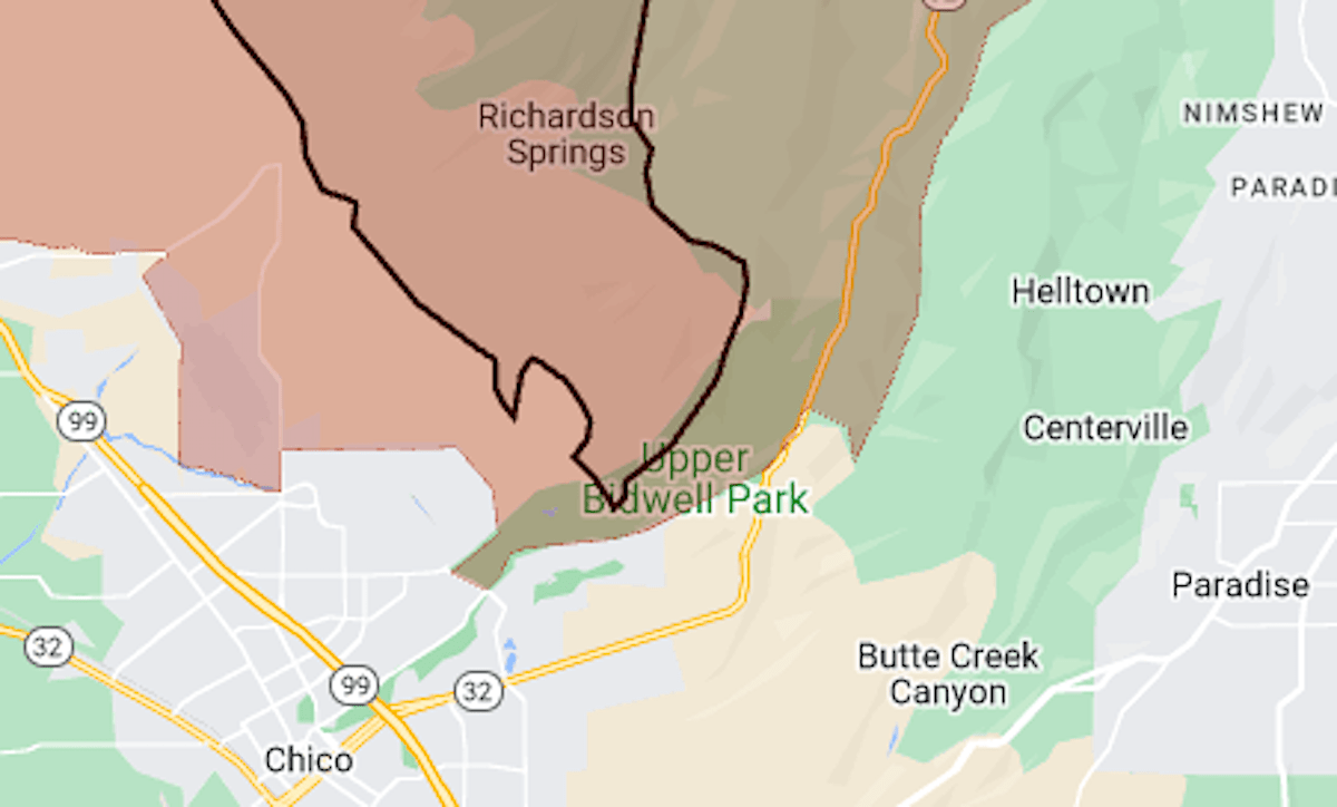
The Park Fire was reported shortly before 3 p.m. in Upper Bidwell Park, the California Department of Forestry and Fire Protection said. Early Thursday, its size was estimated at 45,549 acres (71 square miles).
The first evacuation order came before 6 p.m., and by Thursday morning the evacuation zone covered more than 400 square miles in Butte and Tehama counties.
The map above shows the fire’s approximate perimeter as a black line and the evacuation area in red.
For details of the evacuation zone, including warning areas, see the Butte County evacuation map or the Genasys Protect map (Tehama County only).