Even as the Park Fire’s growth slowed, more evacuation zones have been added at its north end.
Related Articles
DA: Arson suspect reportedly ‘heavily intoxicated’ before Park Fire ignition
Man defends his home as Park Fire push devastation and spread smoke across US West
Puppies saved from Park Fire were ‘all over the place’ in rescue chopper
Wildfire smoke may be worse for your brain than other air pollution, study says
Park Fire grows to sixth largest in state history as Creek, Point fires near containment
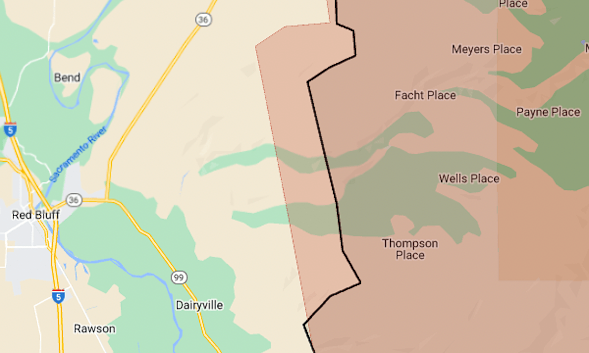
Increased fire activity on Monday evening prompted evacuation orders in the Battle Creek area of Shasta County. The evacuation zone was within 4 miles of the community of Lake California and within 9 miles of Interstate 5 near Cottonwood.
At the fire’s southern end, evacuation orders were reduced to warnings on the east side of Highway 32 and for Forest Ranch.
As of 6 a.m. Tuesday, July 30, the fire had burned 383,619 acres (599 square miles) and was 14% contained, the California Department of Forestry and Fire Protection said.
The map above shows the approximate fire perimeter as a black line and the evacuation area in red.
The fire started in a Chico park on the afternoon of Wednesday, July 24. CalFire investigators say it was arson.
For details of the evacuation zone, including warning areas, see the Butte County evacuation map or the Genasys Protect map (Tehama, Shasta and Plumas counties).