Two weeks after it started, the Park Fire is burning actively toward Mount Lassen, and firefighters are bracing for more high temperatures and low humidity.
Related Articles
Cause of the 2020 Markley Fire? Arson, says a CAL FIRE battalion chief
Park Fire grows but remains at 34% containment
Edgehill fire in San Bernardino damages or destroys 4 homes, evacuations in place
Map: Edgehill fire burning in Southern California
Park Fire reaches 34% containment but activity expected to increase
As of the first report on Wednesday, Aug. 7, the fire had burned 420,827 acres (657 square miles) — an increase of about 7,000 acres in 24 hours. Containment was 34%.
The growth was an arm extending toward the Mill Creek area. On Monday night, Aug. 5, new evacuations were ordered in that area of Tehama County. The following day, the fire crossed Highway 172 near Jones Valley.
It was about 7 miles south of Lassen Volcanic National Park, which has been closed since July 27 because of the fire.
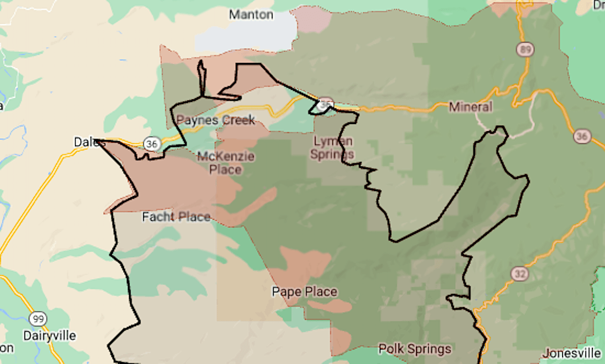
The map above shows the approximate perimeter of the fire as a black line, and the evacuation zone in red.
As of Aug. 7, 600 square miles was under evacuation order. Except for three Butte County zones along Highway 32, all of the orders were in Tehama County.
The fire started July 24 in a park at the edge of Chico. Arson is suspected.
For details of the evacuation zone, including warning areas, see the Butte County evacuation map or the Genasys Protect map (Tehama, Shasta and Plumas counties).