Wildfires are causing air quality in the “unhealthy” category in some areas of California.
Related Articles
How the Park Fire and other California wildfires get their names
Crozier Fire map: Evacuations of Sierra communities, smoke over Lake Tahoe
Air quality advisory issued as wildfire smoke blankets Bay Area
Grass fire spreads to barn, abandoned buildings off Montague Expressway
Wildfires create smoke clouds that hold heat and warm the earth, researchers say
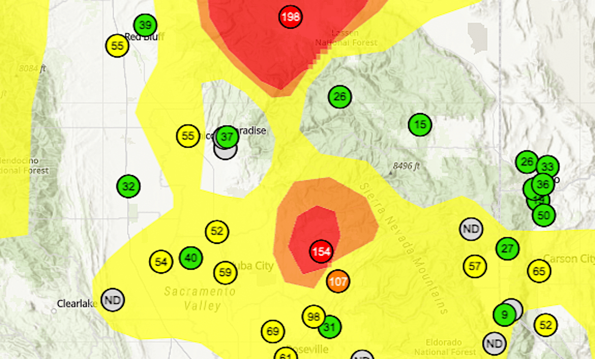
The map above, from AirNow, uses the official U.S. Air Quality Index, with color coding to designate the range of air pollution hazards. It measures ozone and particulate matter.
A number above 150 — in the red, purple or brown categories — is considered unhealthy for all people.
The highest readings on Friday, Aug. 9, were in the areas of the Park and Crozier wildfires. Crozier, in El Dorado County, is sending smoke into the Lake Tahoe basin; readings of 180 were recorded there on Thursday.