With the Crozier Fire holding steady over the weekend, the evacuation zone was reduced in the Sierra Nevada near Placerville.
Related Articles
Air Quality advisory effective through Sunday
Canyon Fire evacuation order lifted for Tuolumne, remains for its outskirts
Map: Wildfire smoke readings in Lake Tahoe and across California
How the Park Fire and other California wildfires get their names
Crozier Fire map: Evacuations of Sierra communities, smoke over Lake Tahoe
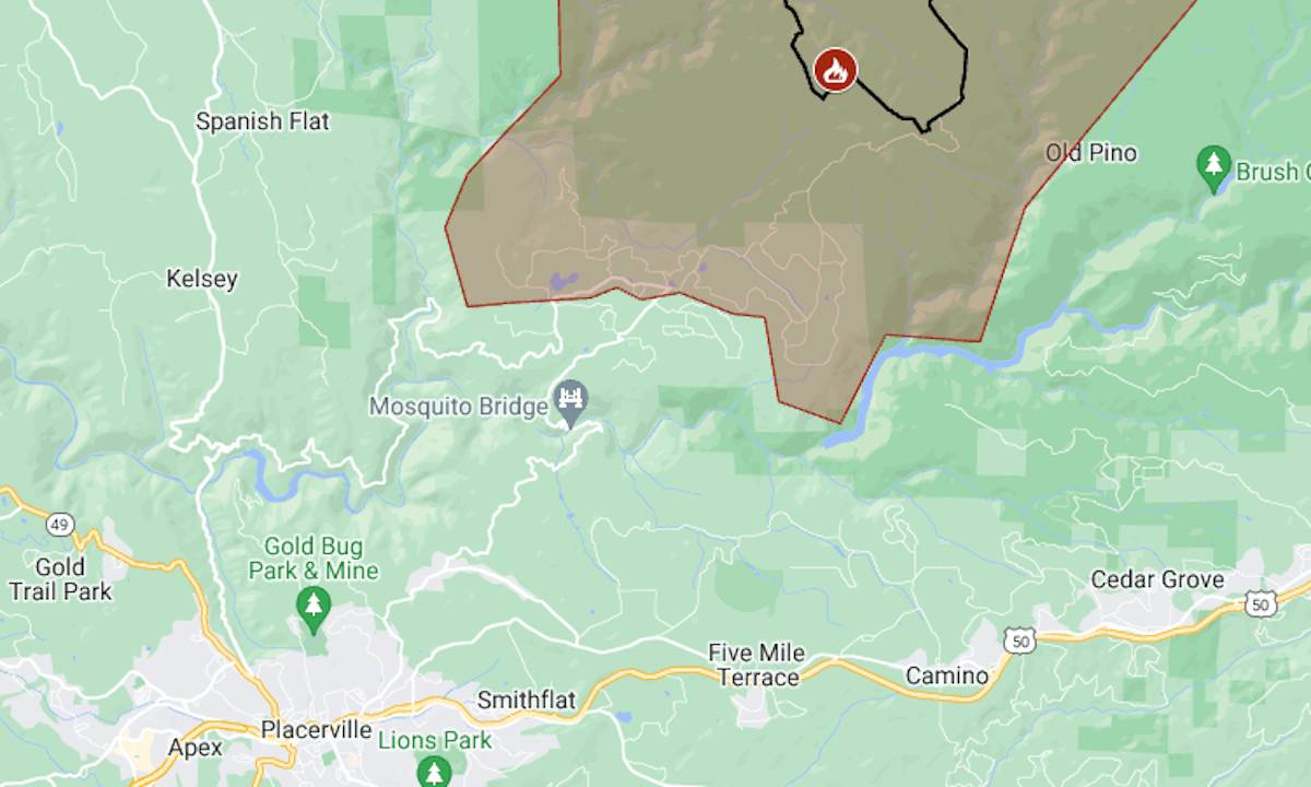
On Sunday, residents were allowed to return to their homes, except for those in an area of about 40 square miles including Mosquito and Swansboro, El Dorado County officials said.
The map above shows the fire’s approximate perimeter as a black line and the evacuation area in red.
The Crozier Fire was reported around 11 p.m. Tuesday, Aug. 6, as a half-acre vegetation fire in Eldorado National Forest about 6 miles north of the Highway 50 town of Camino. The first evacuations were ordered within a few hours.
Sunday’s report from the California Department of Forestry and Fire Protection put Crozier’s size at 1,938 acres (3 square miles) with 18% containment.
For more details of the evacuation, including warning zones, see the map on Perimeter. El Dorado County has set up a non-emergency line for fire information at (530) 621-7676 and also has a webpage about the fire.
Video of Sunday’s community meeting about the fire can be found on CalFire’s YouTube page.