Evacuations were ordered in the first hour of a fire Sunday afternoon in Clearlake.
Related Articles
Wildfire burning east of LA sparks mandatory evacuations
Severe wind and fire: Tips to prepare your property
Southern California wildfire spreads to San Bernardino National Forest
Map: Boone Fire near Coalinga burns into season’s No. 6 spot
Man accused of starting Bay Area wildfire pleads not guilty to charges
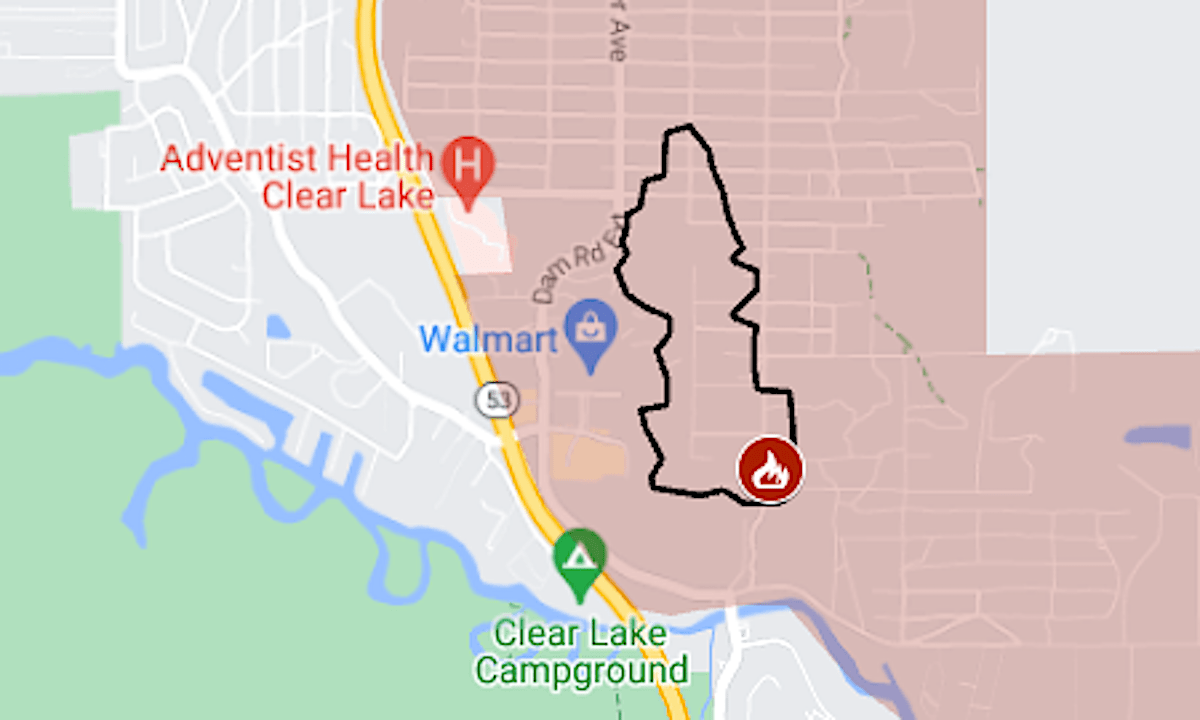
The Boyles Fire was reported around 2 p.m. near Boyles and 8th avenues, at the city’s south end. Before 4 p.m., the California Department of Forestry and Fire Protection called it “a fast-growing fire burning in heavy brush” and said about 30 structures were involved.
The map above shows the approximate perimeter as a black line and the evacuation area in red.
For more details of the evacuation and updates, see the Genasys Protect map or the X feed of CalFire’s Sonoma-Lake-Napa unit.
The fire overlaps with the area burned by the August 2021 Cache Fire, which also forced evacuations in the city.