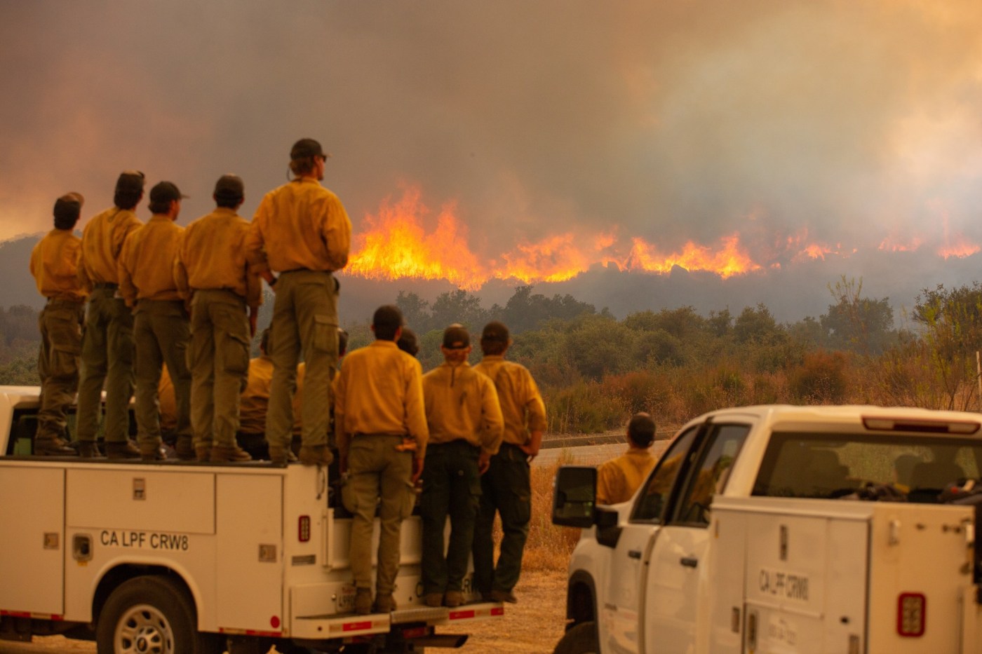
Out-of-control wildfires persisted across Southern California on Tuesday even as a lengthy, triple-digit heat wave eased.
Related Articles
Map: Where Southern California’s three big wildfires are burning
The Bridge fire burning in the Angeles National Forest since the weekend jumped to 46,727 acres on Tuesday and was still zero percent contained. Evacuation orders were expanded, including the city of Wrightwood.
Firefighters have focused on the south side of the fire and were assisted by night-flying helicopters that dropped fire retardant on the wildfire for more than five hours. The south side along with the east and west flanks remain the top priority to protect communities, communication systems and power infrastructure, officials said.
The Bridge fire started in the East Fork Road area Sunday afternoon, Sept. 8; firefighters had not yet determined the cause.
The fast-moving Airport fire, which broke out in Trabuco Canyon near Rancho Santa Margarita on Monday, Sept. 9, swelled to 22,376 acres Tuesday, fire officials said.
Tal Hayes, fire chief for the Cleveland National Forest, said they are trying to survey damage to 36 cabins in Trabuco and Silverado Canyons.
The blaze was believed to have started unintentionally from the use of heavy equipment by an Orange County public works crew while placing boulders meant to replace barriers to restrict access to vegetation. It was first reported just before 1:30 p.m. Monday in the 32200 block of Trabuco Creek Road, Orange County Fire Authority Deputy Chief TJ McGovern said.
“The cause of the fire was a spark from heavy equipment,” McGovern said on Monday. “After placing a load of boulders, the operators began seeing smoke coming from the area of the loader’s basket.”
Although the massive Line fire in the San Bernardino National Forest is burning toward the resort community of Big Bear, incident commanders Tuesday were confident in firefighters’ ability to stop the march of the flames.
Related Articles
Map: Where Southern California’s three big wildfires are burning
Jeremy Renner thanks firefighters protecting Lake Tahoe home from Davis Fire
Map: Davis Fire between Reno and Mt. Rose entering ‘particularly dangerous’ phase
Evacuations still in effect at Boyles Fire near Clearlake
Out-of-control Line Fire in Southern California threatens more than 36,000 homes and structures
“Right now, the fire is laying down,” Cal Fire Battalion Chief Brent Pascua said at about 8:30 a.m. “Things are looking good as far as that section of the fire.”
Ground and air crews were focusing on that area, Pascua said. Officials had said at a news briefing Monday night that winds from the southwest were expected to push the flames through steep terrain and dry brush to the northeast toward Big Bear in the next 36 hours.
An evacuation warning was issued for the Big Bear Dam area “out of an abundance of caution,” Pascua said.