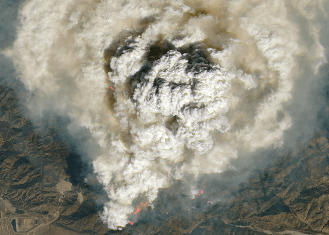
California’s Line Fire is burning so intensely that it created its own weather.
Dramatic pyrocumulus, or “fire clouds,” exploded over the fire Monday at the exact time a high-resolution weather satellite hundreds of miles above Earth’s surface was looking down at the planet.
Pyrocumulus clouds form over intense heat sources, like raging wildfires or volcano eruptions. The air above such intense heat is quickly and chaotically forced to rise, which cools and condenses the air’s moisture, forming clouds.
Pyrocumulus clouds form from the Line Fire in Southern California on Monday, September 9.(NASA via CNN Newsource)
But pyrocumulus clouds also ingest large amounts of smoke and ash from the fires that form them, making these clouds a lot darker than a typical white, puffy cloud.
That’s exactly what the Landsat-8 satellite, a joint data-gathering venture between NASA and the United States Geological Survey, saw on Monday.
Related Articles
Map: Airport, Bridge and Line fires burning in Southern California
This is what Southern California wildfires destroyed in 7 days
Airport fire destroys cabins in historic Holy Jim Canyon
Davis Fire has Acalanes scrambling to find new football opponent
Crews battle wildfire near Highway 4 in Bay Point
Massive pyrocumulus clouds bubbled up above the raging Line Fire, sending plenty of smoke and ash thousands of feet into the air. These clouds looked more like dirty cauliflower or used cotton balls on the satellite imagery compared to the puffy, white cumulus clouds to the east of the fire.
The pyrocumulus clouds were also surrounded by smoke that appears light brown or tan-colored on the satellite image.
Later in the day, the Line Fire’s pyrocumulus clouds eventually morphed into pyrocumulonimbus which produced lightning and rain, according to NASA.
While rain from a storm like this may help firefighting efforts, the gusty thunderstorm winds and additional lightning strikes on dry areas could ignite new fires.
Satellite imagery captures the Line Fire’s pyrocumulus clouds on Monday, September 9. Pink-ish and orange areas highlight active fire hot spots.(NASA via CNN Newsource)
The-CNN-Wire
& © 2024 Cable News Network, Inc., a Warner Bros. Discovery Company. All rights reserved.