Fire officials have announced an interactive map so residents can see if their homes or commercial properties were damaged or destroyed in the Bridge fire.
Related Articles
Here’s how crews are making progress battling Southern California’s 3 wildfires
2 men arrested after $1.5 million of marijuana found in during California wildfire patrol
Opinion: Wildfire readiness is important in Saratoga
AI sensors installed around Peninsula to detect wildfires
Cooler weather in Southern California helps in wildfire battle
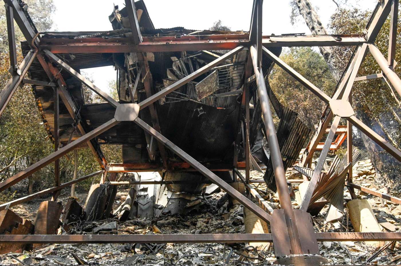
As of Sunday morning, the map showed 58 structures were destroyed or damaged. Most were destroyed.
There also were 12,168 structures threatened, Cal Fire said.
The fire as of Sunday afternoon, Sept. 15 was estimated at 54,033 acres — up from 53,783 acres on Saturday evening — with 9% containment.
Firefighters continued establishing containment lines with dozers and hand crews throughout the fire area on Saturday night, Cal Fire said in a status report on Sunday. But helicopters could not fly Saturday night because the smoke inversion layer hampered visibility.
Along Highway 2 and other roads in Wrightwood, a number of fallen trees have posed a hazard, and firefighters need time to remove them, the agency said.
But the northwest flank of the fire has been the highest priority, where the blaze is backing down to Big Pines Road and infrastructure near the Angeles Forest Service campgrounds.
The east side of the fire, meanwhile, still presents risks to residents in the Mt. Baldy area, so evacuation orders remain in effect.
In Los Angeles County, they include the East Fork communities, including Camp Williams Resort (the café, mobile home park and campground), and the nearby River community.
In San Bernardino County, they include:
Mt. Baldy Road, all residents north of the San Antonio Dam up to the Mt. Baldy Resort.
The community of Wrightwood.
The area from Highway 138 south to the northern border of San Antonio Heights, extending north to the Wrightwood evacuation zones and east to Cucamonga Peak.
In the past week, the Bridge fire became the largest active wildfire in the state.
The blaze began Sunday afternoon, Sept. 8 near East Fork and Glendora Mountain roads, Angeles National Fire officials said. The fire exploded in size at the end of an protracted heat wave on Tuesday, destroying dozens of structures as it raced into San Bernardino County.
Some 2,453 personnel have joined the firefight, including 50 crews, 203 engines, 21 dozers, seven water tenders and 13 helicopters.