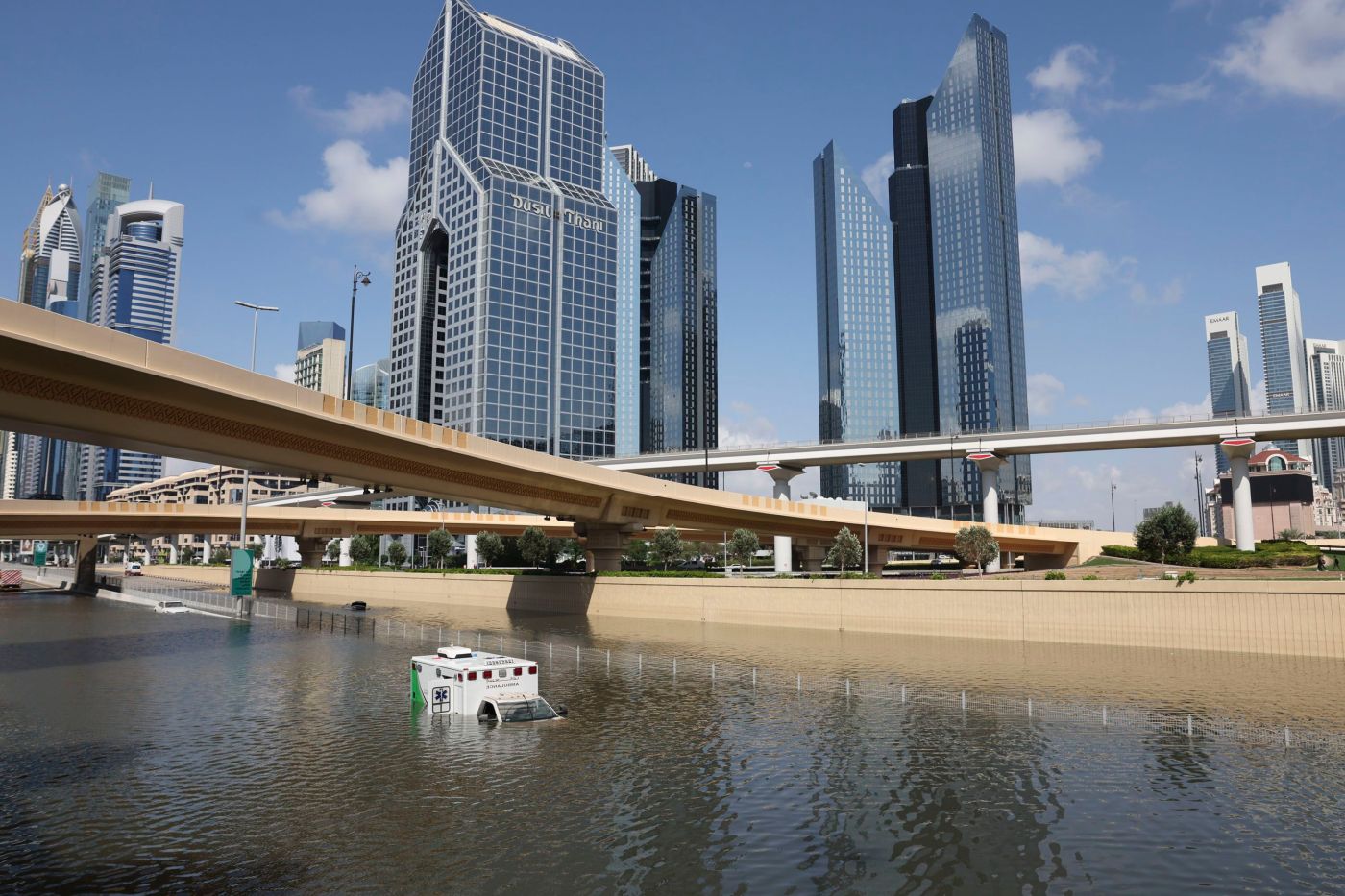
A torrent of rain on Tuesday flooded parts of Dubai, turned streets into rivers and shut down the world’s second-busiest airport for a time. The deluge of water triggered the question: Was this disaster caused by the United Arab Emirates’ cloud-seeding program?
Officials at the country’s National Center of Meteorology have been cited as saying the rain was not caused by cloud seeding. CNN has reached out to the center for comment.
But even if the program did fly its planes through the sky leading up to the storm, it’s exceedingly unlikely the efforts would have produced more rain than was going to fall naturally.
These understandable attempts to squeeze more moisture out of clouds have been around for decades, but with little evidence of success.
But that hasn’t stopped some countries, including the UAE, China and the US, from trying to modify the weather.
Here’s what to know about cloud seeding.
What is cloud seeding?
Cloud seeding is a weather modification concept that attempts to draw more rain or snow out of a cloud than would occur naturally.
Cloud droplets don’t form spontaneously. The moisture needs something to condense on – like the water that forms on the side of a cold glass on a hot day. In a cloud, so-called condensation nuclei are teeny, tiny particles in the air the moisture can grab onto.
Cloud seeding adds more of those particles to the air. Aircraft fly through existing clouds and inject the tiny particles, like silver iodide, with the goal of creating more water or ice droplets.
In any cloud, once enough droplets merge, they become heavy and fall to the Earth as rain or snow.
Natural tiny particles, like dust and dirt, typically serve as the driving force for clouds to condense and let go of their moisture. Silver iodide can theoretically serve the same purpose.
Does cloud seeding work?
It’s incredibly difficult to determine what – if any – impact cloud seeding has on precipitation. Experimentation and attempts to quantify its effectiveness have been fraught with challenges.
“How do you know how much precipitation that might actually end up falling from that cloud occurred due to the seeding? Or how much would have fallen without the seeding?” Daniel Swain, climate scientist at UCLA, previously told CNN. “This isn’t a setting where you can do a truly controlled experiment.”
Researchers have tried. A 2020 study published in the Proceedings of the National Academies of Sciences, indicated one cloud seeding experiment may have produced up to 10% more precipitation than would have fallen naturally.
But skepticism still lingers in the scientific community.
“There needs to be controlled studies that actually shows it was the seeding that increased the precipitation in a meaningful way,” Swain asserted.
What harms could cloud seeding do?
As the climate continues to warm due to human-caused climate change, certain parts of the world are becoming hotter and drier. Cloud seeding could be perceived as a solution to bring more water to areas that need it, but it could also potentially make other areas drier in the process.
Water – like any other matter – cannot be created or destroyed. It can only be transformed while moving through the closed loop of the water cycle.
“It is possible that you’re actually stealing water from someone else when you do (cloud seeding), because it may be, at least on a regional basis, a zero-sum game where if water falls out of the cloud in one spot, it’s even drier by the time it makes it downwind to the next watershed,” Swain said.
An extreme storm system drove torrential rainfall
Related Articles
Storms batter the South, leaving one dead in Mississippi
Northeast digs out from heavy storm, power still out to many
2024’s ‘extremely active’ hurricane season could bring 23 named storms, experts say
April storm: More than 600,000 without power on the East Coast
Severe weather carves path across several states, at least 1 dead
The heavy rain that set off unprecedented flooding in the United Arab Emirates, Oman and Iran didn’t just appear out of nowhere. It also didn’t only affect areas that participate in cloud seeding.
Torrential rainfall was driven by a large, slow-moving storm that traversed the Arabian Peninsula and tracked into the Gulf of Oman over the course of multiple days. This storm was able to take deep, plentiful tropical moisture located near the equator and unload it like a firehose over the region.
Regardless of whether cloud seeding occurred, the storm was part of an extreme set up that appeared in forecast models days in advance.
Torrential rainfall events like this will become more frequent as the atmosphere continues to warm, allowing it to soak up more moisture like a towel and to ring it out as flooding rainfall.
CNN’s Rachel Ramirez and Angela Fritz contributed to this report.
The-CNN-Wire
& © 2024 Cable News Network, Inc., a Warner Bros. Discovery Company. All rights reserved.


