Another wave of rain was expected to reach the Bay Area on Monday and stay until Tuesday night.
Related Articles
More light rain expected through Bay Area ahead of next storm arrival
Who gets more disaster aid? Republican states. Experts explain that and more about FEMA
Sierra Nevada snowpack declines after very dry January — but promising storms are arriving to replenish it
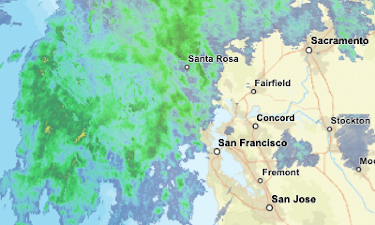
Live map: Where it’s raining in the Bay Area
Elias: California water agency supply estimates should be more realistic
The updating radar map above shows current areas of precipitation in green, with greater intensities indicated by yellow and orange.
The National Weather Service issued several advisories related to the storm, including:
• A flood watch for most of the Bay Area until 4 a.m. Wednesday.
• A wind advisory for the San Mateo County coast until 8 p.m. Tuesday.
• A winter storm warning for the Lake Tahoe area until 7 a.m. Wednesday, with 1 to 3 feet of snow above 7,000 feet elevation and wind gusts up to 100 mph on the ridges. “Travel could be very difficult to impossible, especially over passes,” the weather service said.
• A winter storm warning for Yosemite and the southern Sierra Nevada until 10 a.m. Wednesday, with up to 4 feet of snow possible.