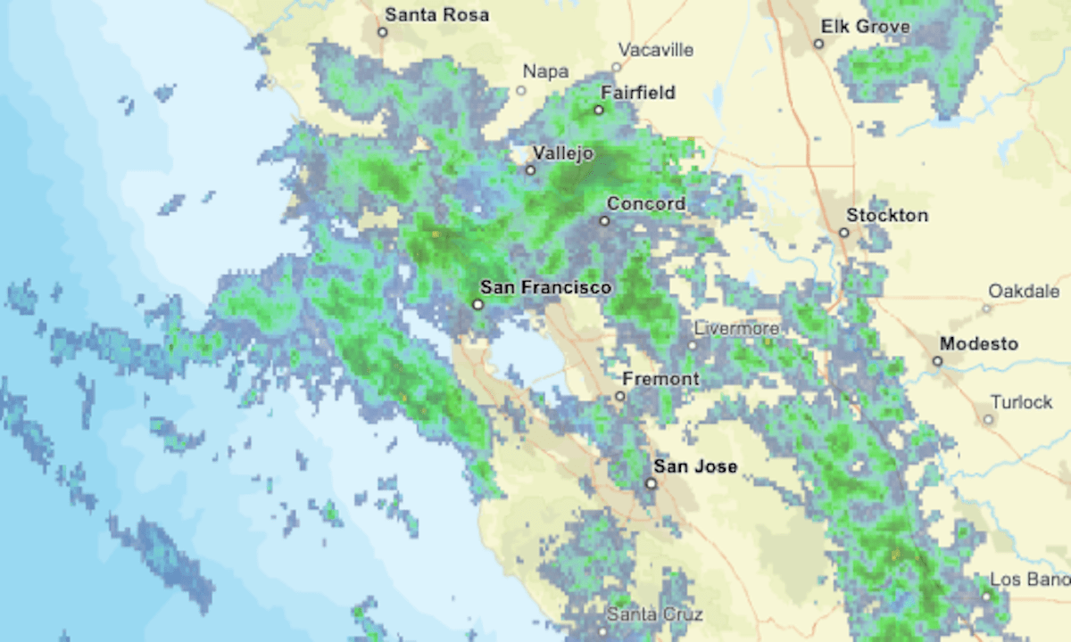
A cold, rainy storm was forecast to move into the Bay Area on the morning of Saturday, May 4, and linger into late afternoon.
Related Articles
Another winter-like storm moving into Bay Area slower than anticipated
Rainy season isn’t quite over yet as Bay Area braces for another cold storm
Highway 1 repair work near Big Sur hampered by winds
Marine Cloud Brightening project aims to combat global warming
Big Sur Highway 1 repair work hitting its stride
The updating radar map above shows areas of precipitation in green, with greater intensities indicated by yellow and orange.
A winter weather advisory is in effect for the northern Sierra Nevada, including Lake Tahoe, from 11 a.m. Saturday to 8 a.m. Sunday. The National Weather Service predicts a “high-impact spring storm” with heavy snow and high winds, and it warns of “difficult to impossible” driving above 5,000 feet elevation.
Updates on road conditions can be found on CalTrans’ website or mobile app or by calling (800) 427-7623.


